NAVIGATING THE JOY IN MAKING

I wonder if maps are used more often than ever before? Digital, never ending maps on our tiny screens, suggested modes of transportation, how long each of them will take, the paths we should follow, the things we will see along the way. Some other entity has mapped out the routes we take. We are removed from our surroundings and our sense of adventure. You feel it most when your phone dies and you have to rely on bus stop maps, a sixth sense, is this way north?
I like the feeling of moving somewhere new, when at first it all feels separate. I walk this way to the park, the Sainsburys is down a different road, a different planet, but then one day you take a left instead of a right and the separate entities start to connect, the turns that are unfamiliar become known avenues and shortcuts. There are a million ways to get onto the canal. Bus routes start making sense. The many routes that will lead you home. A ranking system naturally forming. That way is a little too steep, but you can pass through the park. The Nisa at the south end of the road has better croissants, but the other one is closer. Once in a while you miss the 390 bus, follow the route until the next one. The pathways becoming treaded with our footsteps and memories. I eat by my window and look outside, I see the same person walk down my road everyday, a tank top, shorts, even in winter, a tote bag and an incredible stomp. I wonder who sees me, whose common character am I? And how would they describe me?

Earlier this year, as part of the Voices of the Water project, the Fellows set out to create an artwork exploring the question “What does water mean to you?” Through a series of workshops with creatives Tori Flower and Sam Griffiths, we produced a visual depiction of our reflections, memories and stories of water. Taking inspiration from our cultures and experiences and guided by the local area of Kings Cross and the River Fleet.
We began the project by discussing the purpose of maps, and the many ways they are used. We looked at examples: traditional maps, used to convey routes and paths; political/social maps used to highlight issues or celebrate achievements; and artist interpretations of maps, used to tell stories, or even in some cases communicate with friends. One of the examples which stood out for me was Giorgia Lupi, a designer who hand draws data visualisations using simple mark marking. Amongst the examples of maps was her book - Dear Data, which documents a year-long project with another data designer - Stefanie Posavec, in which they recorded data about their lives on postcards and sent them back and forth.
It made me think of my good pal, flatmate and creative collaborator who travels into work everyday on the tube. One evening she texts me:
“The world is a shadow world. Shadow people move around me and I, myself a shadow, move amongst them. They stare at me and I see nothing behind their cold blank eyes. What do they see in mine? We all ignore the disembodied voices speaking over fuzzy tannoys; they don’t yet realise they are ghosts. We live below the crust of the earth, in sooty tunnels. Since the sun cannot reach us, we are more like wispy smudges. Like smears in the air. We swirl and glide like smoke but if we should stop moving for even a second, we would find ourselves falling, in our final moments, to the ground like a pile of soot.” - Lily Limmer

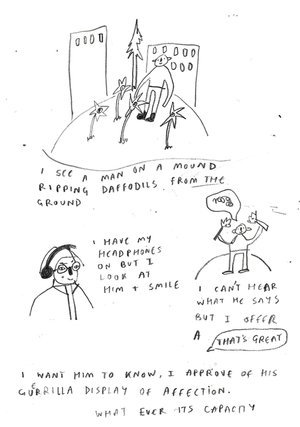
I tell her it makes me think of a Lowry painting and I draw her a comic. The tube gives us the perspective of travelling in straight lines. That the city exists in lines and dots on a map, one after another. There are no wrong turns.
One evening I’m taking the same journey home as her, I think to myself wouldn’t it be funny if Lily was… she shouts my name, I am a face amongst the shadow people.
Back in our workshops, we discussed at length whether or not maps could be objective, in seeing a map of the world “upside down” we discussed whether or not it was really “upside down”, or if it was all in the perspective. It was interesting to think about maps in this way. They often feel scientific, artefacts of truth, a road is a road, a hill is a hill. But there will always be things that are left out that seem unimportant to some, but crucial to others.
Recently at a protest, a man asked me and my friend if we wanted to sign up to Just Stop Oil’s mailing list. He said that if he got a certain amount of sign ups he would get a badge! I tell him that I recently got a badge from Google Maps, for being a star reviewer. My reviews are not good, often they are requests for a DJ to play better music or a way to say thank you to a takeaway for putting chips into a naan despite it not being an option on the menu. He tells us that Google Maps has been used by activists recently to relay information about the war in Ukraine to people in Russia who have limited access to news outside of what the government wants them to know. In this way Google Maps has become a political tool, and even if at times it feels as if a robot is mapping our once intuitive paths, Google Maps is actually an amalgamation of billions of peoples thoughts and opinions, and images and favourite spots from around the world.
We finished off the first session by each creating a map of our local area. We started by drawing what we do there, then on a tracing paper overlay recorded what we thought about and how we felt there, creating colour codes for feelings and different types of markings for thoughts. We each presented our maps at the end and it was intriguing to see how we had approached the same prompts so differently. Some maps had zoomed all the way out to the universe, showing us that the local area could be inside of you, your home is your mind. Others showed only the most important places, the most visited, the most trodden paths, some more traditional, with roads you could follow. This felt like a useful step into creating our group piece, how all the different ways we were experiencing the world could tie into one.
Over the next few workshops we worked as a team to plan out what we wanted to include in our artwork. We used the mythical story of the River Fleet/Taniwha as a guide, and as a base for our map. We explored questions around water such as:
What memories do you have that involve water?
What stories and myths have meaning to you that involve water?
What facts & historical stories about the river fleet have stuck with you?
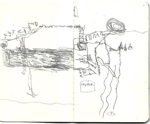
Then through a selection process we chose the ideas we felt were most important and began to plan out how they would work best on the map. Did we want it to be accurate to location or did we want the viewer to jump around through time and space? We experimented with ink and wax which gave the piece a watery feeling. We worked together to illustrate, colour and place our memories, stories and experiences along the path of our Taniwha.
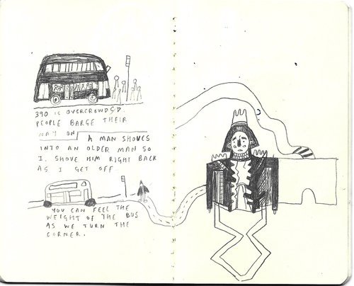
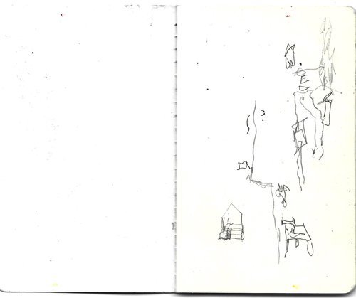
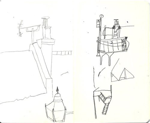
As the project went on I felt more and more inspired to be an observer and to draw once again. I carried around a small sketchbook and a small Ikea pencil and I began to map out the world around me. When walking a familiar route I would take out the sketchbook and draw as I walked. I sat and drew trees, felt the park and all its memories - benches, roller-skates, a burial ground for mice. Made comics about the funny interactions I had. I began to reflect on how I felt my best when I was really feeling the world around me, when I had time to slow down and walk around, discover new things. That so much of my creative process was about the joy in making and in having time to think and watch and just be.

Notes from the Garden
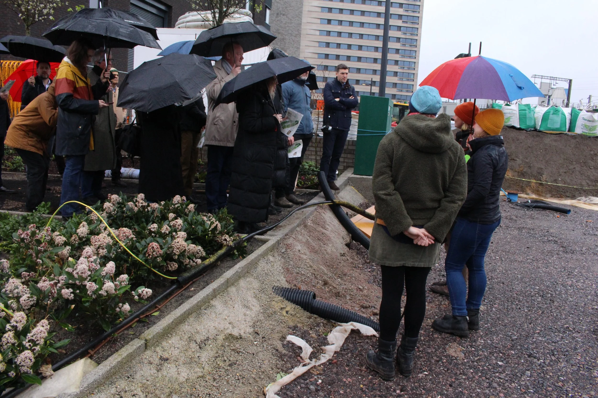

The barge art session hosted by Sarah Pimenta and Pia Jones was reviving.